Breathe in the sulphur-rich air of Rotorua and you’ve already got a taste of NZ’s most dynamic thermal area with spurting geysers, steaming hot springs, and exploding mud pools. The Maori revered this unique topography, naming one of the most spectacular areas Waiotapu (wai=water and tapu=sacred). We explored several of the attractions in this area.

Lady Knox Geyser spouts off daily (with a little help from an organic soap) at 10:15 am. We were there later in the afternoon so she was just puffing a bit.
The mud pools were quite fragrant. It was a lot of fun to predict where the next big bubble would burst. The challenge came in factoring in the digital camera delay to get a good shot.


With the help of excellent directions in the Lonely Planet guide book, we were able to find Kerosene Creek, one of the few places left where the public can bathe in natural thermal pools for free. We were the only people at the pool so our au natural dip was quite relaxing. The combination of the warm water and the pounding falls on a sandy bottom made for a pleasant, albeit smelly, spa experience.


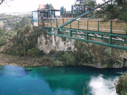
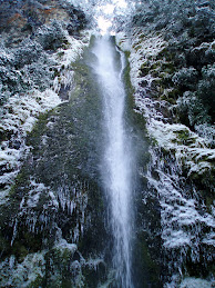
 Just a little bit north and downstream from Taupo Bungy, NZ’s longest river, the Waikato is slammed into a narrow chasm and then makes a spectacular 10 metre drop into a surging pool. It was easy to see why the Maori named the torrent Hukanui (Great Body of Spray).

Back down at the edge of Lake Taupo, we stopped to take in the very cloudy view of the peaks of Tongariro National Park across the lake. There were some young kids throwing rocks into the water and then being very surprised as the rocks floated back to shore. Remember the density of pumice and that this is a volcanic area.
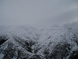
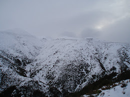
Driving south along the edge of Lake Taupo and then Tongariro National Park on the Desert Road reminded me of the Saddle Road on the Big Island (Hawaii). We were rewarded with a gorgeous view of Mt Ruapehu as the clouds suddenly parted and then swiftly disappeared. Sadly, we did not have time to ski the active volcano (the ski area is on the north side of the mountain and not visible in the photo). From June to September 1996 it spurted volcanic rock and cloaked the area in clouds of ash and steam writing off the 1996 ski season..jpg)
As a reminder of were we are on the Pacific Ring of Fire, there was a strong earthquake in Napier the night before we arrived there. Napier was levelled in 1931 by a 7.9 quake. The city quickly rebuilt itself in the Art Deco style.
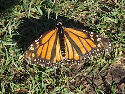
 Unfortunately the only photo we got was of a butterfly in the garden above the cave. Underground areas are not conducive to photography and glow worms definitely do not like cameras.
 The night before our cave foray we stayed on a nearby farm above the small town of Te Kuiti. How small was it? –well there were barefoot kids in the grocery store. The combination of small town and clearing skies resulted in a gorgeous sunset and then fabulous star gazing.

After the sun set we watched Venus set, got a great view of the Milky Way, and spotted the Southern Cross. Really, it is up there.

Doug also had to take the requisite Matson shot of a moth the next morning.
 The farthest north we got on the west coast was Hokianga Harbour. North Island has numerous bays, inlets, and harbours which almost bisect the island. Hokianga is unspoiled and beautiful.

The dunes on the north side were spectacular.

The Tasman Sea here is pretty rough. This view is north along the coast.
 This area is incredibly rural with little development. Here is a typical roadside pastoral scene with sheep and calla lilies. Spring was definitely in full bloom here. The NZ sheep population has dropped in the last few decades from about 60 to 40 million but there are still a lot of sheep here.
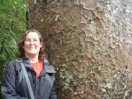
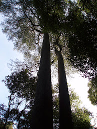
 From Hokianga, we wound our way south along the Kauri Coast to marvel at the magnificent kauri forests. The Kauri Coast is named for the kauri timber and gum industry that flourished here in the 19th century, generating much of NZ’s wealth at the time. Waipoua Kauri Forest was proclaimed a sanctuary in 1952 and is the largest remnant of the once-extensive kauri forest that blanketed northern NZ. It was slow going for 18 km on the winding mountain road through the lush forest of ferns and native trees but worth every minute of it for views of the magnificent giants. We walked in to see Te Matua Nghere (The Father of the Forest). With a trunk of over 5 metres in diameter it is believed to be the widest kauri in NZ and could be the oldest in NZ at about 2000 years old.
 We also stopped to visit Tane Mahuta (named for the Maori god of the forests), the largest kauri tree in NZ and estimated to be between 1200 and 2000 years old. At 51 metres, it is taller that Te Matua Nghere but not as wide. That little orange dot is me.
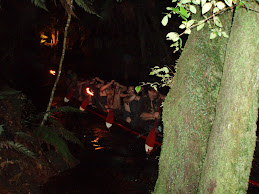
There are over 300 mapped caves in the Waitomo District. The name Waitomo is fitting (wai=water and tomo=hole) as the countryside is dotted with shafts dropping into the underground cave systems and streams. The limestone caves with their accompanying formations make up the area’s premier tourist attraction. We signed on with the Legendary Black Water Rafting Co for their Black Labyrinth Tour. After donning wet suits and helmets with lamps, we climbed, walked, crawled, squeezed, swam, tubed, and jumped off waterfalls on our 2 hour underground trip through the cave stream. The hot shower and hot lunch provided at the end were much appreciated. The most amazing part of the trip was the Glow Worms. At numerous points in the cave, we turned off our headlamps and were surrounded by a Milky Way of little lights, once our eyes grew accustomed to the dark. Glow worms are the larvae of the fungus gnat, which looks like a large mosquito without mouth parts. The larva glow worms have luminescent organs that produce a soft greenish light. Living in a hammock suspended from an overhang, they weave sticky threads that trail down and catch unwary insects attracted by their lights. When an insect flies towards the light, it gets stuck in the threads and becomes paralyzed – the glow worm reels in the thread and eats the insect. The larval stage lasts for 6 to 9 months, depending on how much food the glow worm gets. When the glow worm has grown to about the size of a match stick, it goes into a pupa stage, much like a cocoon. The adult fungus gnat emerges about 2 weeks later. The adult insect does not live very long because it does not have a mouth. It emerges, mates, lays eggs, and dies, all within about 2 to 3 days. The sticky eggs, laid in groups of 40 to 50 hatch in about three weeks to become larval glow worms. The glow worms that shine the brightest are the hungriest.
 Unfortunately the only photo we got was of a butterfly in the garden above the cave. Underground areas are not conducive to photography and glow worms definitely do not like cameras.
 The night before our cave foray we stayed on a nearby farm above the small town of Te Kuiti. How small was it? –well there were barefoot kids in the grocery store. The combination of small town and clearing skies resulted in a gorgeous sunset and then fabulous star gazing.

Doug also had to take the requisite Matson shot of a moth the next morning.
 The farthest north we got on the west coast was Hokianga Harbour. North Island has numerous bays, inlets, and harbours which almost bisect the island. Hokianga is unspoiled and beautiful.
The dunes on the north side were spectacular.

The Tasman Sea here is pretty rough. This view is north along the coast.
 This area is incredibly rural with little development. Here is a typical roadside pastoral scene with sheep and calla lilies. Spring was definitely in full bloom here. The NZ sheep population has dropped in the last few decades from about 60 to 40 million but there are still a lot of sheep here.
 We also stopped to visit Tane Mahuta (named for the Maori god of the forests), the largest kauri tree in NZ and estimated to be between 1200 and 2000 years old. At 51 metres, it is taller that Te Matua Nghere but not as wide. That little orange dot is me.
Whether it is on land, in the air, or in the water, the sights of NZ continue to astound me. Around every bend in the road there is something even more spectacular to encounter. I am running out of superlatives.